
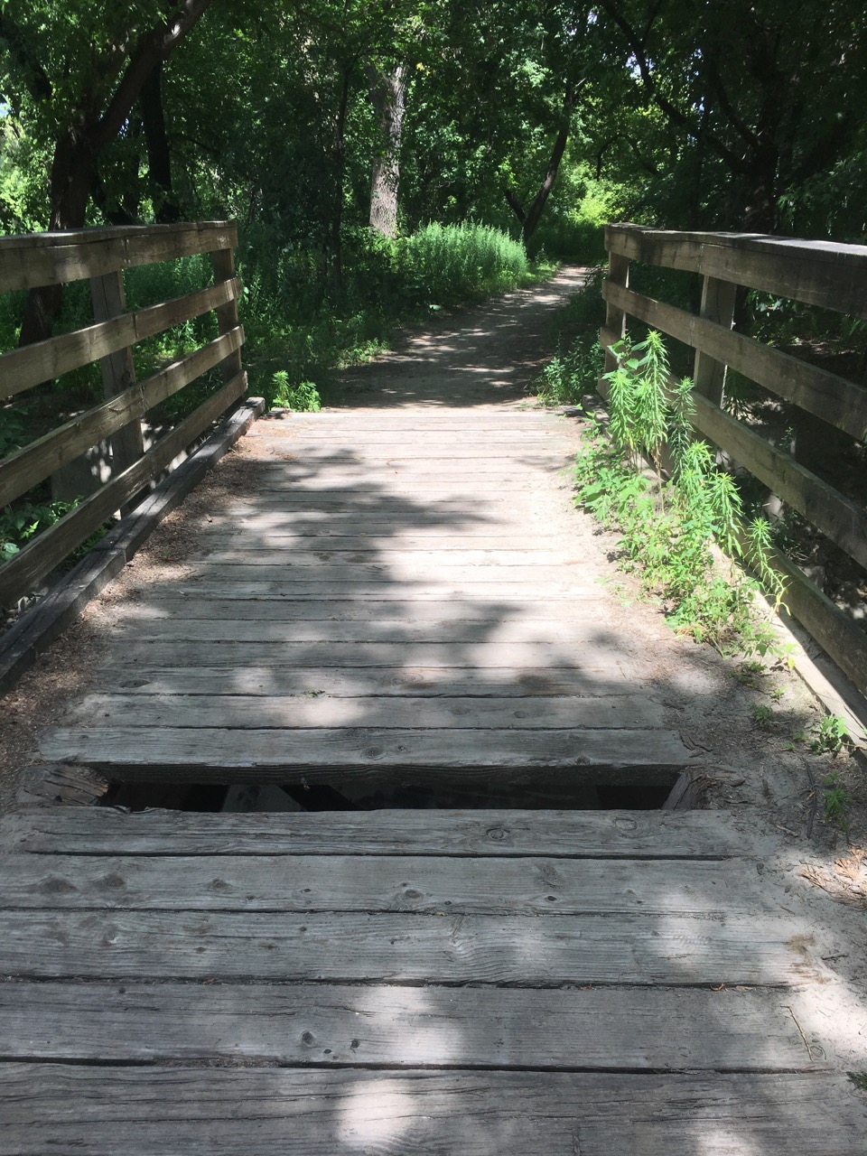

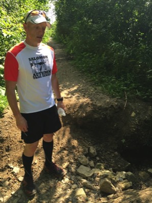
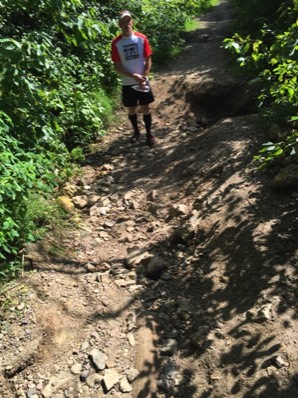
Above are some of the conditions of the Mendota trail and for what we are raising more. The planks on this bridge and others have been fixed. With the erosion of the river bank. The plan is to move the trail in further and utilize existing structures.
2019 Runs Start and Finish
The race starts and finishes on the trail south of D St.
The course has three out and backs: one is at the new trailhead, second is just short of the intersection for Pilot Knob Rd and Hwy 13 and third is at Lilydale Yacht Club.
The course crosses Sibley Memorial Highway twice. We will have volunteers there. Please only when it is clear of traffic.
Follow the trail and the orange directional signs.
10 Mile Course Map
5k
The race starts and finishes on the trail south of D St.
The course is an out and back just past the West trailhead.
The course crosses Sibley Memorial Highway once. We will have a volunteer there. Please only when it is clear of traffic.
Follow the trail and orange directional signs.
5k Course Map
The race starts on the trail south of the parking lot next to the wood memorial.
Follow the trail and the orange directional signs.
The finish line is on the pavement near the wood memorial.
10 Mile Course Map
5k
The race starts and finishes on the pavement near the wood memorial.
Follow the trail and orange directional signs.
5k Course Map
Course Descriptions (click for intersection map)
5K: From the memorial follow the pavement to the intersection C and veer left.
At intersection B go straight across the bridge on to Pike Island, intersection L.
Make a left at intersection L (Aid Station) and follow the trail around Pike Island.
When you reach intersection M make a right following the trail up the hill.
At intersection N go straight to intersection L.
Make a right at intersection L crossing the bridge heading back to the starting line by veering right at intersection B, then veering left on the pavement at intersection C.
10 Mile: From the start line make a left at intersection A.
At intersection B turn left to intersection C.
Continuing left at intersection C you will pass the Visitor Center continuing on the pavement toward intersection D.
When you reach intersection D stay straight on the pavement to intersection E.
Continue straight at intersection E as the surface changes to gravel and you circle Snelling Lake.
Cross the road at the park entrance, intersection F, to intersection G.
You will go through he chain making a left on to the pavement at intersection G.
Follow the pavement to intersection H where you will go on to the road.
You will on the road until you reach the road to Picnic Island at intersection I.
Making a quick zig zag at intersection I on to the gravel trail.
The gravel trail will take you to intersection J where you will make a right and pass by intersection A to intersection B.
Make a right at intersection B crossing the bridge to Pike Island and making a right at intersection L (Aid Station).
Once on Pike Island you will make two loops, veering right at intersection M and straight at intersection N.
After your second loop make a right at intersection L crossing the bridge heading toward the finish line, veering right at intersection B and veering left at intersection C on to the pavement.
Cross the finish line and grab your t-shirt and Lucky's 13 beverage voucher.
The race starts at the light pole just past the parking lot North of D St.
Follow the road to the tunnels at the bottom of the hill, make a right to pass through the tunnels.
Make a left after the tunnels to get onto the trail.
Follow the trail and the orange directional signs.
The first bridge you will run under is the Hwy 55 bridge.
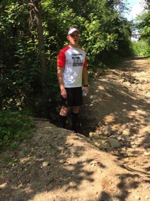
Last year's donation paid to fix the giant hole just past the bridge that resulted from in a wash out caused by runoff and flooding.
5K: Turnaround is ~1.55 miles from the start, turn around and follow the trail back to the tunnels.
10 Mile: Continue past the 5k turnaround.
About 1 mile down the trail you will reach the Hwy 494 bridge where the water stop #1/#3 is located.
Approximately 2.5 miles down trail you will reach water stop #2 and the turnaround.
Turn around and follow the trail back to the tunnels.
Make a right in to the tunnels.
Make a left back on to the street and uphill to the finish line at the light pole.
Cross the finish line and grab your t-shirt and Lucky's 13 beverage voucher.

Our Sponsors:


Directed by:

Other Mountain Goat Running Events: